New Wilderness Alliance Brings Forth Bold Proposal
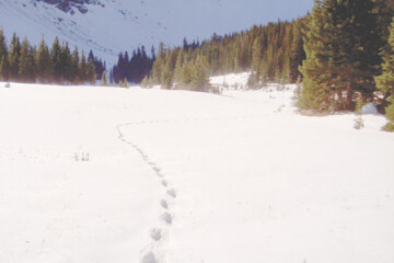
The new Gallatin Yellowstone Wilderness Alliance (GYWA) has identified Montana’s Custer Gallatin National Forest (CGNF) as the epicenter for some of the most spectacular wild lands in the nation. “We are talking about the top one or two per cent of wild country in the lower 48,” said Phil Knight of the GYWA. These wild lands are some of the best wildlife habitat in the country, providing a home for Grizzly Bear, Lynx, Wolf, Elk, Moose, Mountain Goat, and Bighorn Sheep, and are the source of waters that support genetically pure Yellowstone and West Slope Cutthroat Trout.
“We want to see these lands protected forever. Wilderness is the best way to do that,” said Knight. “People from around the world look to this region for its wildlife and big, undeveloped open spaces. Let’s keep it that way.”
GYWA believes the CGNF is not the nation’s wood box, nor should it be the nation’s outdoor gymnasium. What the CGNF does best is provide for high-quality wild lands.
Wild lands protection is critical to the quality of life of the region’s communities, and essential to the outdoor economy that draws visitors. It also contributes to the well-being of residents by providing clean water, important fish habitat, critical wildlife habitat, and scenic beauty.
According to Conservation Biology principles, larger protected areas are better than smaller patches of habitat. That is one reason it is important to conserve larger unprotected wild lands, especially if they are contiguous to existing protected areas. Adding adjacent roadless lands to existing wilderness is important for enhancing the overall conservation value.
In addition, some wild lands are critical corridors for the movement of wildlife between other protected landscapes. For example, the Bridger Range can serve as a corridor connecting the Greater Yellowstone Ecosystem to other lands further north.
Here’s a breakdown of the GYWA proposed new Wilderness areas:
Gallatin Range 546,000 acres
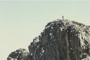
The Gallatin Range is the largest unprotected roadless area in Montana and a key part of the Greater Yellowstone Ecosystem. The Gallatin Range portion of the Custer Gallatin National Forest stretches 50 miles from Yellowstone Park north to Bozeman including the popular Hyalite Canyon area.
The Forest Service identified some 251,700 acres in its Wilderness Inventory, including the Hyalite-Porupine-Buffalo Horn WSA. The full Gallatin Range Roadless area extends south into Yellowstone National Park and takes in an astounding 546,000 acres.
The Gallatin Range higher elevations feature glacially carved cirques and grassy ridges. There are a lot of open grassy valleys and slopes which are exceptional wildlife habitat, particularly the Porcupine-Buffalo Horn drainage where thousands of elk winter. Three drainages - Mol Heron, Tom Miner, and Rock Creek - that flow from the Gallatin Range are considered essential Yellowstone Cutthroat trout habitat by Montana Fish Wildlife and Parks. The Gallatin Range also supports Grizzly Bear, Wolf, Mountain Goat, Wolverine, Bighorn Sheep, Moose, Mule Deer, and potentially wild Bison.
The largest petrified forest in the world is found at the headwaters of Porcupine, Rock, Tom Miner, and Buffalo Horn drainages. Commercial and amateur collectors have ravaged this world-class complex. Wilderness designation would help to halt this tragic damage.
Since 1977, approximately 155,000 acres have been protected as the Hyalite-Porcupine-Buffalo Horn Wilderness Study Area. In total, there are about 230,000 acres of potential wilderness, but the Custer Gallatin National Forest has only recommended about 85,000 in two units and proposes that the Buffalo Horn drainage be designated a backcountry area. The Buffalo Horn drainage is the most important wildlife habitat in the entire Gallatin Range - if any area should be Wilderness, this is it.
Many roadless drainages in the Gallatin Range were left out of wilderness recommendations including the upper portions of South Cottonwood, Sourdough, Trail Creek and others.
Crazy Mountains 90,960 acres
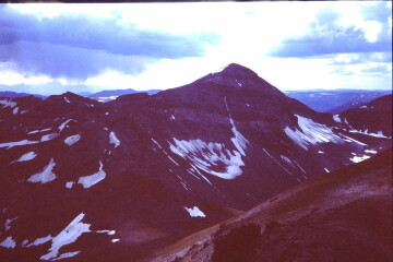
Rising 7,000 feet above the plains (as much as the Tetons rise above Jackson Hole), the Crazy Mountains have numerous peaks over 10,000 feet, including 11,201 foot Crazy Peak. The range also harbors 30 alpine lakes and even a few small glaciers. The Crazies are well known for their geological radiating volcanic dike system and heavily glaciated peaks and valleys. The range is considered sacred to the Crow Tribe. The Crazy Mountains have been included in previous wilderness bills.
The Custer Gallatin National Forest recommended no wilderness in the Crazy Mountains, partly due to checkerboard inholdings in the range. The Custer Gallatin National Forest identified 90,690 acres as roadless, but split this into two units for no apparent reason. This is considerably less than the 135,500 acres the Forest Service identified as roadless in the 1980s. Conservationists should insist that at least 90,690 acres be recommended for wilderness with the caveat that private inholdings should be aggressively removed through land trades or purchase.
Madison Range 180,000 acres
A significant portion of the Madison Range is protected within the Lee Metcalf Wilderness. However, 111,000 acres in the Cabin Creek Recreation and Wildlife Management Area lies between the Taylor Fork and Hebgen Lake, sandwiched between the Monument Peak area and the main crest of the Madison Range. This exceptional wildland is without wilderness protection. It is critical Grizzly Bear habitat, and also could support wild Bison herds. Nearly 50 miles of stream support West Slope Cutthroat Trout.
The FS does not recommend wilderness here because of on-going biking and ORV/snowmobile use, but that is no excuse. The area easily qualifies for wilderness based on its essential character and should be added on to the Lee Metcalf Wilderness.
Another significant 43,000 acre roadless area lies between Big Sky and the Taylor Fork. This area of rolling hills, open meadows, and scenic view is also critical wildlife habitat. The area should be added to the Lee Metcalf Wilderness. Grizzly Bear are utilizing this area.
A third 17,000 acre roadless portion of the Madison Range north of the Spanish Peaks that includes the upper Cherry Creek and Spanish Creek drainages would connect the Madison Canyon and Spanish Peaks as a continuous unit. Known as Cowboy’s Heaven, it is part of a 26,000-acre roadless area that is split between the Custer Gallatin National Forest and Beaverhead-Deerlodge National Forest. It should be added to the existing Spanish Peak unit of the Lee Metcalf Wilderness. It contains some of the best lower elevation big game habitat, and is used by several thousand Elk.
Pryor Mountains 45,500 acres
The Pryor Mountains lie south of Billings and are primarily limestone. There are deep canyons and grassy ridgelines. The area is part of a larger roadless area that could contain lands managed by the BLM and NPS. The FS recommends a paltry 6,804 acres in Lost Water Canyon for wilderness. Wilderness in the Pryors could be expanded with the closure of a few tracks and dirt roads.
We support 13,000 acres in the Lost Water Crooked Creek area - not just the 10,421 acres that the Custer Gallatin National Forest inventoried as roadless. ALL of this area passed the U.S. house in Pat Williams’ Wilderness bill in 1994. (In 2015, BLM added 11,00 acres of Lands with Wilderness Character to their 22,000 acres of WSAs from the 1980s.)
In addition, there are three more roadless areas that should be protected as wilderness:
Punch Bowl / Dryhead Creek Canyons RWA (~8,500 acres)
Incredible wild country. This will require converting at least a couple miles of unfortunate 4WD road to motor-free along the ridge between the two canyons.
Big Pryor RWA (12,000 acres)
A couple of miles of little used “motorized trail” ought to be converted to motor-free to improve the integrity of the area.
Bear Canyon RWA (10,000 acres): This one should be a total “no-brainer” as there are no roads here.
Bridger Mountains 45,000 acres
The dramatic face of the Bridger Range walls in the Eastern side of the Gallatin Valley. The Bridger Bowl Ski area is located on its eastern flank. The Bridger Range is an important corridor between the Greater Yellowstone Ecosystem and Central Montana. The range supports important winter deer habitat at lower elevations and its streams hold genetically pure West Slope Cutthroat trout and Yellowstone Cutthroat trout. Approximately 45,000 acres of the Bridger Range is roadless and surprisingly the FS did not recommend a single acre for wilderness. The area around Blacktail Peak in the northern Bridger Range has about a third of this roadless component and should be recommended for wilderness.
Lionhead (Southern Madison Range) 32,000 Acres
The 32,000-acre Lionhead Roadless area includes 18 miles of the Continental Divide Trail and lies to the west of Hebgen Lake. There are a number of alpine lakes, dramatic cirques, and many open meadow areas. The area is a critical corridor that links the Yellowstone Park area to the Lee Metcalf Wilderness and ranges to the west, like the Centennials and Gravelly Range. The CGNF has recommended nearly 18,000 acres as wilderness, though their 1986 Forest Plan had recommended 22,000 acres for wilderness. They should be commended for including the Lionhead, but the recommended wilderness should be enlarged to include most of the 32,000-acre roadless area.
Absaroka Beartooth Wilderness Additions 298,623 Acres
There are many potential additions to the Absaroka Beartooth Wilderness. Starting in the east, there is the Line Creek Plateau near Red Lodge. Steep timbered canyons flank this high alpine grassland which supports 20 rare or uncommon plants. The plateau is over 10,000 feet in elevation. The Custer Gallatin National Forest has recommended only 801 acres out of 32,983 roadless acres with some on the Shoshone National Forest. The plateau is so special that the Forest Service has designated 16,127 acres as the Line Creek Research Natural Area. At least 30,000 acres should be recommended for wilderness.
The West Fork and Lake Fork of Rock Creek by Red Lodge and the Beartooth Front from Red Lodge to East Rosebud drainage comprise 34,640 acres of roadless lands adjacent to the existing Absaroka Beartooth Wilderness that includes 27 miles of trail. The West Fork of Rock Creek is the municipal watershed for Red Lodge. In particular, all the roadless lands in both the glaciated valleys of the West and Lake Forks of Rock Creek should be recommended as wilderness.
The 25,000 acre East Rosebud to Stillwater roadless area along the Beartooth Front provides for the access to East and West Rosebud, as well as Stillwater trailheads. All should be protected as wilderness.
Along the north face of the Absaroka Beartooth Wilderness are any number of roadless lands that should be added to the list of recommended wildernesses, including the 129,000-acre Deer Creek drainage lying between the Boulder River and Stillwater River, and includes lands surrounding the East Boulder, Lower Deer Creek, Upper Deer Creek and Bridger Creek. This area, which is mostly foothill terrain, is largely missing from the Absaroka Beartooth Wilderness. It is important elk and deer habitat, not to mention genetically pure Yellowstone Cutthroat Trout in the upper Deer Creek drainages. At least half of this area could be managed reasonably well as wilderness.
The 5,000-acre Mount Rae between the Boulder and West Boulder Rivers is another area with aspen and meadows and good wildlife habitat.
The 8,000-acre Tie Creek/Mission Creek/Livingston Peak including the north face of Shell Mountain with trailhead access near the 63 Ranch east of Livingston Peak provides the scenic backdrop to Livingston. Little Mission and Mission Creek both harbor genetically pure Cutthroat Trout. All of this area should be protected.
In Paradise Valley, much of the lower foothills of the Absaroka Mountains are not within the wilderness, the entire roadless terrain of 13,000 acres from Deep Creek to Strawberry Creek along the Absaroka Front should be added to the Absaroka Beartooth Wilderness.
The Chico Peak, Emigrant Peak and Dome Mountain roadless area (56,000 acres) reaches from Cedar Creek near Gardiner, north to Passage Creek in the Mill Creek drainage. Except for existing mineral claims, the entire area should also be added to the Absaroka Beartooth Wilderness. These lands are critical migration corridors and winter range for elk and bison moving north from Yellowstone as well as important grizzly bear habitat. Six Mile Creek has pure Yellowstone Cutthroat trout populations.
It’s time to recognize that our national forest roadless areas are more valuable and precious every day. In a world consumed by extreme weather, industrial pollution, plastic waste, overpopulation and extinction crisis, we are blessed to have here in Montana some places not yet despoiled. Join the Gallatin Yellowstone Wilderness Alliance in called for Wilderness protection for the roadless lands of the Custer Gallatin National Forest.
The Gallatin Yellowstone Wilderness Alliance was formed in order to protect and restore wildlands of the Custer Gallatin National Forest, and other lands of the northern Greater Yellowstone Ecosystem. You can find GYWA at gallatinyellowstonewilderness.org or at PO Box 5256 Bozeman MT 59717.